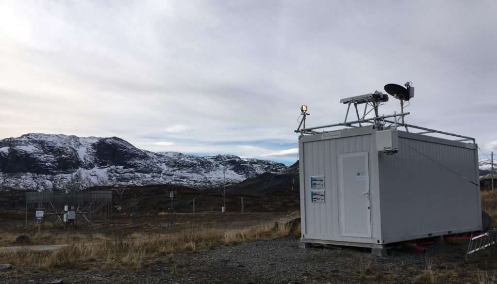
Field Deployments
We deploy and operate instrument sites in various regions of North America and Europe, as well as collaborate with instrument scientists all over the Northern Hemisphere. Many of the sites are located in regions with an abundance of snowfall. Locations include: The Great Lakes region (including the Upper and Lower Peninsulas of Michigan), Norway (shown, left), Sweden, Finland, Greenland, and Alaska (planned for 2023). We maintain and deploy both in situ and remote sensed instrumentation and have several active field campaigns. (Supported by NSF OPP, NSF PDM, NOAA WPO, and NASA NIP funding)
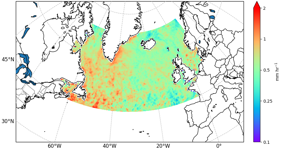
Satellite Observations
We utilize observations from passive and active sensors on NASA and NOAA satellites to characterize precipitation, often with a focus on snowfall, mixed-phase precipitation, or the precipitation phase. For example, we combined observations of precipitation rate from the NASA Global Precipitation Measurement (GPM) satellite with identified high-latitude Atmospheric Rivers (shown, right). Other studies from the group used observations from NASA CloudSat to examine snowfall in Greenland and NOAA GOES-16 to develop a lake-effect snow now-casting product. (Supported by NASA PMM ST and NASA NIP funding)
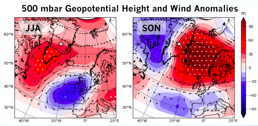
Snowfall Regimes
We leverage ground-based observations of clouds, precipitation, surface meteorology, and thermodynamic state from a variety of instrument sites and couple these with reanalysis data products to illuminate the synoptic conditions favorable to snowfall. For example, we have examined the impact of atmospheric blocking, where an anomalous, long-lived atmospheric ridge disrupts the mean westerly flow, on snowfall processes atop the Greenland Ice Sheet (shown, left). Similar analyses in other parts of the world have shown seasonal and large-scale dynamics connected to specific snowfall regimes. (Supported by NSF OPP and NASA NIP funding)
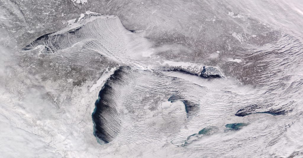
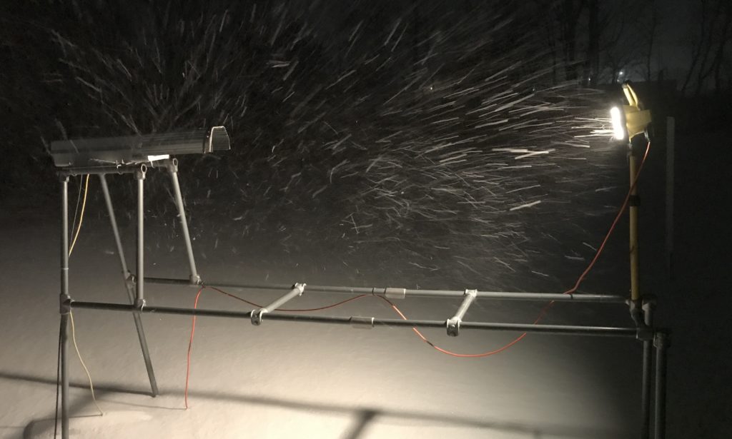
Lake-Effect Snow
We operate and maintain several instrument sites in the Great Lakes region and leverage these observations to better characterize the properties and subsequent impacts of lake-effect snowfall. Lake-effect snow (shown, right) can be very shallow, often with cloud tops less than 1 km above the ground, while still producing high snow rates. Additionally, these systems can be long-lived. The properties of the hydrometeors during lake-effect snowfall are different than those during large (synoptic)-scale snowfall (a.k.a., system snow). Because of the unique properties inherit to lake-effect snow it is therefore hard to accurately characterize using satellite observations. (Supported by NASA PMM ST and NOAA WPO funding).
Instrumentation
We maintain and work with a variety of ground-based instruments that are used for assessment and validation of NASA and NOAA satellite products. We use profiling radars (such as the Metek MRR-2 and MRRPro), heated weighing gauges (like the OTT Pluvio2), laser disdrometers (like the OTT Parsivel), and the NASA-developed Precipitation Imaging Package (PIP) video disdrometer (shown, left). These instruments, combined with observations from the National Weather Service, NASA, and NOAA, are extremely powerful for analyzing rain, snow, and mixed-phase precipitation characteristics and processes.